Derbyshire Public Transport Printable Maps
All maps print on A4 paper except the following:-
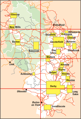
- County map
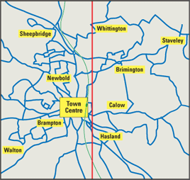
- Chesterfield town plan
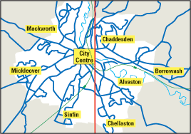
- Derby city map
Click on the area of the mini map you wish to print to open the full scale printable PDF.
Map Index |
County map
Chesterfield town plan
Derby city map
|
 |